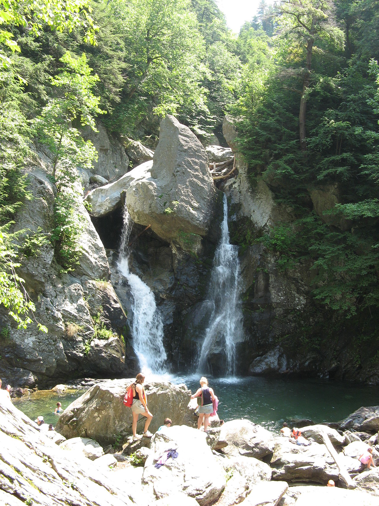
 Photo: User:Garyadam · Public domain
Bash Bish Falls
Worth the drive
Is it plungeworthy?
A tiered on Bash Bish Brook.
The details
- Type
- Tiered
- Watercourse
- Bash Bish Brook
- Coordinates
- 42.11526, -73.49363
About Bash Bish Falls
Bash Bish Falls is a 50-foot tiered in Massachusetts, on Bash Bish Brook.
It's fullest after rain, and flow can drop off during dry spells — plan around recent weather.
Plungeworthy rates Bash Bish Falls 7.5/10 — worth the drive. The score weighs its scale, how confidently it's mapped, and its character.
What you'll find
Bash Bish Falls is Massachusetts' most famous waterfall and its tallest — a 59-foot final plunge split around a jutting rock into twin chutes, at the bottom of a cascade series totaling nearly 200 feet through Bash Bish Gorge in the state's far southwest corner.
It's also the state's most sobering waterfall: more than 25 people have died here over the past century, mostly from falls off the slick rock, and swimming has been banned since the 1960s. The viewing area at the base delivers the full postcard without anyone needing to test the pool.
Two approaches, pick by temperament: the Massachusetts lot on Falls Road drops steeply to the falls in a short, knee-testing descent; the New York lot at Taconic State Park, one state line over, trades distance for grade — three-quarters of a mile of gentle uphill that's the better call with kids.
Getting there
- Trailhead
- Bash Bish Falls State Park, Falls Road, Mount Washington (MA side); or Taconic State Park, Copake Falls NY for the gentler approach
- Parking
- MA lot fits about 24 cars (portable toilets May-mid October); NY lot is larger. Both free
- Road
- Falls Road — paved
- Hike
- 1.5 mi round trip (MA side: short but steep and rocky. NY side: 0.75 miles each way, gentle grade)
- Heads up
- DCR closes the MA-side trail or lot on short notice for maintenance a few times a year — check mass.gov DCR advisories before driving out.
When to go
Spring gives the falls their full twin-chute power; fall wraps the gorge in color and draws the biggest crowds. Open sunrise to sunset year-round, though the MA descent gets icy and treacherous in winter.
Rules & fees
- Fee / pass
- Free
- Dogs
- Leashed (10-foot max, standard DCR)
- Hours
- Sunrise to sunset
- Warnings
- Swimming and climbing on the falls are banned and enforced — the death toll here is real, not signage theater. Stay on the viewing platforms.
Researched from Mass.gov DCR — Bash Bish Falls State Park · Wikipedia — Bash Bish Falls. Conditions change — verify before you drive. Been to Bash Bish Falls recently? Post a conditions report below.
Where it is
Before you go
The pin marks the feature, not a trailhead or a legal route in. Some sit on private land or need a real hike, and conditions change with season and rain. Check local access, don't trespass, and never enter water — hot or cold — where it isn't safe.
Common questions
How tall is Bash Bish Falls?
Bash Bish Falls drops about 50 feet, in Massachusetts.
Where is Bash Bish Falls?
Bash Bish Falls is a waterfall in Massachusetts, at 42.11526, -73.49363.
Is Bash Bish Falls worth visiting?
Worth the drive — Plungeworthy rates it 7.5/10.
Gear for the trip
As an Amazon Associate, Plungeworthy earns from qualifying purchases.
