 Photo: Ljmajer · Public domain
Proxy Falls
Drop everything
Is it plungeworthy?
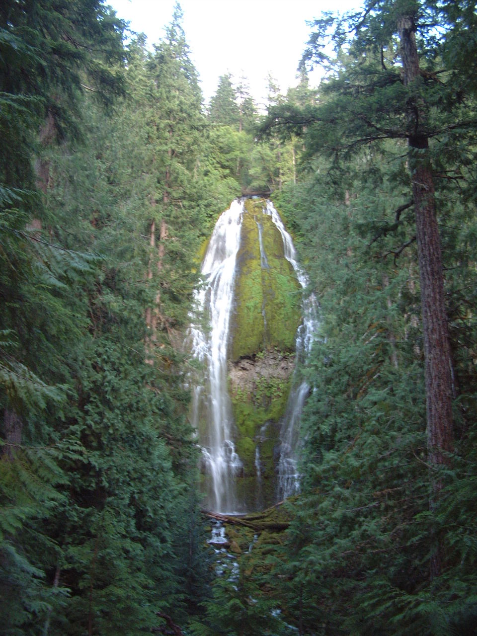
A segmented horsetails on Proxy Creek.
The details
- Type
- Segmented Horsetails
- Watercourse
- Proxy Creek
- Coordinates
- 44.16161, -121.92744
About Proxy Falls
Proxy Falls is a 226-foot segmented horsetails in Oregon, on Proxy Creek.
Fed largely by snowmelt, it runs hardest in late spring and early summer and can thin to a trickle by late season.
Plungeworthy rates Proxy Falls 9.1/10 — drop everything. The score weighs its scale, how confidently it's mapped, and its character.
What you'll find
A short loop through a 3,000-year-old lava flow reaches two falls on Separation Creek: Lower Proxy, a 226-foot bridal-veil fan that pours over a mossy wall and then simply vanishes into the porous lava with no visible outlet, and gentler Upper Proxy a little further on.
The walk itself earns the stop — lava rock, moss curtains, old-growth — even before the falls.
Getting there
- Trailhead
- Proxy Falls Trailhead, on the McKenzie Highway (OR-242)
- Parking
- Small pullout directly off 242; fills by mid-morning in July–August. No vehicles over 35 feet.
- Road
- Paved, but OR-242 is a narrow winding pass road, gated closed in winter
- Hike
- 1.6 mi round trip, 164 ft of climb (easy)
- Heads up
- Loop crosses uneven lava in places. No maintained access to the base of Lower Proxy.
When to go
A summer-and-fall-only falls: OR-242 is typically gated from the first November snow until mid-June (it reopened June 15 for the 2026 season). Snowmelt-fed springs keep the flow honest all season rather than fading like a normal creek.
Rules & fees
- Fee / pass
- $5/day or Northwest Forest Pass / interagency pass for parking, plus a free self-issue wilderness permit at the trailhead kiosk (June 15 – Oct 15). This trailhead does NOT need the limited-entry Central Cascades permit.
- Dogs
- Leashed, 6-foot max
- Hours
- Day use, 6am–10pm
- Camping
- Alder Springs Campground ~1.5 miles; Limberlost also close on 242
- Warnings
- High-fire-danger country in late summer — check Willamette NF alerts and smoke conditions before the pass drive.
Researched from USFS — Proxy Falls Trail #3532 · OPB — McKenzie Pass 2026 opening. Conditions change — verify before you drive. Been to Proxy Falls recently? Post a conditions report below.
Where it is
Before you go
The pin marks the feature, not a trailhead or a legal route in. Some sit on private land or need a real hike, and conditions change with season and rain. Check local access, don't trespass, and never enter water — hot or cold — where it isn't safe.
Common questions
How tall is Proxy Falls?
Proxy Falls drops about 226 feet, in Oregon.
Where is Proxy Falls?
Proxy Falls is a waterfall in Oregon, at 44.16161, -121.92744.
Is Proxy Falls worth visiting?
Drop everything — Plungeworthy rates it 9.1/10.
Gear for the trip
As an Amazon Associate, Plungeworthy earns from qualifying purchases.