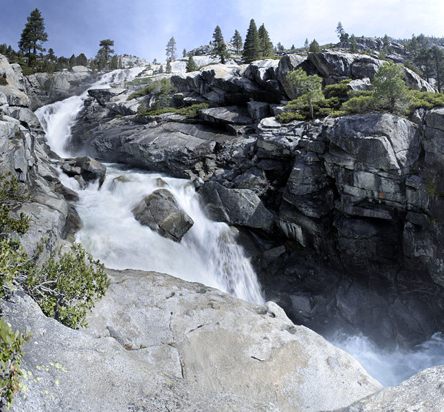
 Photo: Phreakdigital at English Wikipedia · GFDL
Horsetail Falls
If you're passing
Is it plungeworthy?
A horsetail on Dry Creek.
The details
- Type
- Horsetail
- Watercourse
- Dry Creek
- Coordinates
- 40.49865, -111.72787
About Horsetail Falls
Horsetail Falls is a horsetail in Utah, on Dry Creek.
Fed largely by snowmelt, it runs hardest in late spring and early summer and can thin to a trickle by late season.
Plungeworthy rates Horsetail Falls 4.1/10 — if you're passing. The score weighs its scale, how confidently it's mapped, and its character.
What you'll find
A frayed white plume high in the Lone Peak Wilderness above Alpine, earned by a relentless wooded climb with three stream crossings. The falls fans wide over granite — best in June when snowmelt gives it its tail.
Getting there
- Trailhead
- Dry Creek Trailhead, end of Grove Drive, Alpine
- Parking
- Small free lot, no facilities
- Road
- Paved
- Hike
- 4.6 mi round trip, 1,617 ft of climb (hard)
- Heads up
- Wilderness rules apply past the boundary; crossings run high early.
When to go
Late May and June for full flow — by September it's a whisper.
Rules & fees
- Fee / pass
- Free
- Warnings
- Sustained grade; slick crossings in runoff.
Researched from Jordan Outside — Horsetail Falls. Conditions change — verify before you drive. Been to Horsetail Falls recently? Post a conditions report below.
Where it is
Before you go
The pin marks the feature, not a trailhead or a legal route in. Some sit on private land or need a real hike, and conditions change with season and rain. Check local access, don't trespass, and never enter water — hot or cold — where it isn't safe.
Common questions
Where is Horsetail Falls?
Horsetail Falls is a waterfall in Utah, at 40.49865, -111.72787.
Is Horsetail Falls worth visiting?
If you're passing — Plungeworthy rates it 4.1/10.
Gear for the trip
As an Amazon Associate, Plungeworthy earns from qualifying purchases.